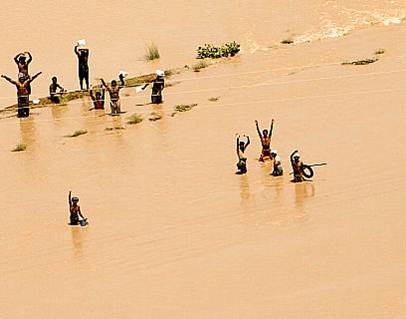
Investment in to flood forecasting early warning systems, according to the World Bank report (2009) on the Climate Forecast Application Network (CFAN) shows a return of 40.85 US Dollars in benefits for every US dollar invested over a period of ten years. RIMES, in collaboration with CFAN, successfully tested and operationalised a flood forecast, with up to 10 days lead time capability.
The flood forecast provides information about the onset of flood, duration, and dates of flood recession. The forecast offers sufficient lead time to interpret and translates information through established communication channels such as a short message service (SMS) bulletins and flood pillars. Evaluation of this project’s impact among target households reveals that an average of 18,637 Bangladeshi Taka has been saved per household due to the increased lead time to implement flood mitigation strategies.
2012 Flood forecasts for Bangladesh : Ganges & Brahmaputra River
About the Forecasts
The forecasts present current ensemble discharge forecasts; for the Ganges River, at Hardinge Bridge and for Brahmaputra River, at Bahadurabad station. The plots below present forecasts of up to 10 days for the river discharge at the respective gauging stations. Shown in these plots are 51 individual ensemble member (colored lines) forecasts. The variance of the ensemble members represent an estimate of the range of uncertainty we expect in our forecasts. The ensemble members were derived by incorporating both the uncertainty in the precipitation forecasts, as represented by the European Center for Medium Scale Weather Forecast (ECMWF) ensemble dispersion, along with all other aspects of uncertainty in hydrological forecasts models.
The black solid lines show the observed discharge using rating curve derived from data based on the Flood Forecasting and Warning Center (FFWC) of Bangladesh.
The dashed horizontal line is the discharge corresponding to the “Danger Level” stage height for each respective river. The danger levels are water levels significantly above normal flood levels, and represent the potential for loss of life and severe infrastructure damage. The vertical line marks the last date the forecasts were initialized, and represents the beginning of the forecast horizon.