Model Development and DSS integration for Flood Forecasting in Odisha
RIMES is working closely with the Odisha State Disaster Management Authority (OSDMA) to strengthen OSDMA’s technical capacities to anticipate and manage disaster risks by customising Decision Support System (DSS) tools for carrying out dynamic assessment of risk in key sectors and keeping officials informed of the potential impacts.
Implemented through the Operational Systems for Integrated Disaster Risk Management project, based on the MOU between RIMES and OSDMA of 2018, the DSS enables OSDMA to provide timely warning and advisory information through enhanced dissemination mechanism to stakeholder departments for better decision making, and minimise potential losses due to potential hazards.
Key activities:
- Development, testing in a user environment, and integration into OSDMA operations of the following decision support systems for automated assessment of risks and evaluation and dissemination of risk and resource management actions, informed by climate information at different timescales
- Heat wave advisory system
- Drought risk monitoring and management system
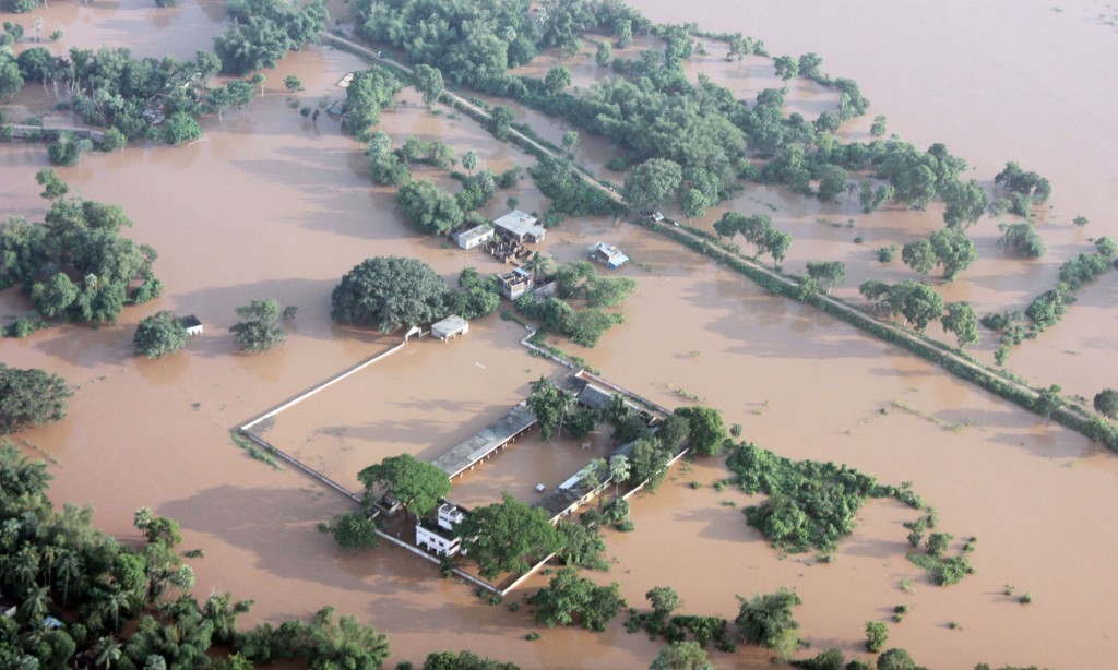
- Flow forecasting and flood early warning system
- Forecasting of lightning accidents and striking hazard
- Road accident monitoring and reporting system
Integration of INSPIRE
- Training of relevant OSDMA personnel, collaborating departments, and other relevant stakeholders in the operation, maintenance, and further development of these decision support systems
- Training of users on application of information products from these decision support systems in planning and decision-making for managing risks and resources
- Support to OSDMA in the operation of these decision support systems

Flood Forecasting
Flood forecasting is one of the major components of the system in two pilot river basins of Mahanadi and Rushikulya, and with the Department of Water Resources (DoWR) providing the data required for initial model customization, RIMES customized the models for both basins.
Mahanadi River Basin Model currently has a total of 39 sub basins and 29 forecasting locations, which was delineated based on the suggestions and operational requirements from DoWR officials. Forecast verification for the 2020 monsoon season was performed by RIMES.
Highlights:
- Rainfall forecast based on RIMES WRF (3 days lead-time) is integrated in the DSS and is available for all 39 sub-basins.
- Hydrologic model (HEC-HMS) has been set up for the basin and initial calibration is complete based on the available data.
- Hydrological forecast with 3 days lead-time is generated for all stations on an experimental basis.
- Several hydrologic models were tested, and lumped models indicated better performance at all stations.
Rushikulya River Basin Model has 15 sub-basins and 8 forecast locations (including the outlet), which were delineated based on the requirements of DoWR officials (outcome of April 2019 workshop)
Highlights:
- This basin has WRF rainfall forecasts are available for all sub-basins
- A semi-distributed hydrologic model developed in HEC-HMS is available for Rushikulya RB with three days of lead-time. However, calibration was done at only one forecast location (Purusottampur) due to limited data availability.
- A lumped model, IHECRAS-CWI was also tested which showed better performance.
- IHECRAS-CWI is used to obtain forecasts at Purusottampur with a lead-time of 3 days in SATARK.
- Error correction module can significantly improve the accuracy of the forecast and is planned with availability of real-time daily observations at forecast locations (with a maximum lag of 7 days).