Flood forecast information with sufficient lead time is critical to managing risks to vulnerable groups and reducing socio-economic impact.
The Asia-Pacific region is home to large river systems with transboundary river basins that are prone to flooding, resulting in severe impact beyond geographical boundaries. The Indus, Ganges, Brahmaputra-Meghna, and Mekong, for example, are resources to over 1 billion people but are at high risk of transboundary flooding.
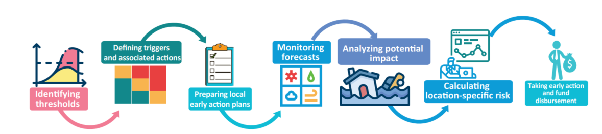
Flood risk management is the key to the development of long-term solution technology. Risk-based forecasting and dissemination tools are vital components of flood risk management in areas with extensive human settlements and development on the natural flood plain. Flood simulation and risk assessments are indispensable strategic planning tools for the effective reduction of flood risk and damage to communities and livelihoods.
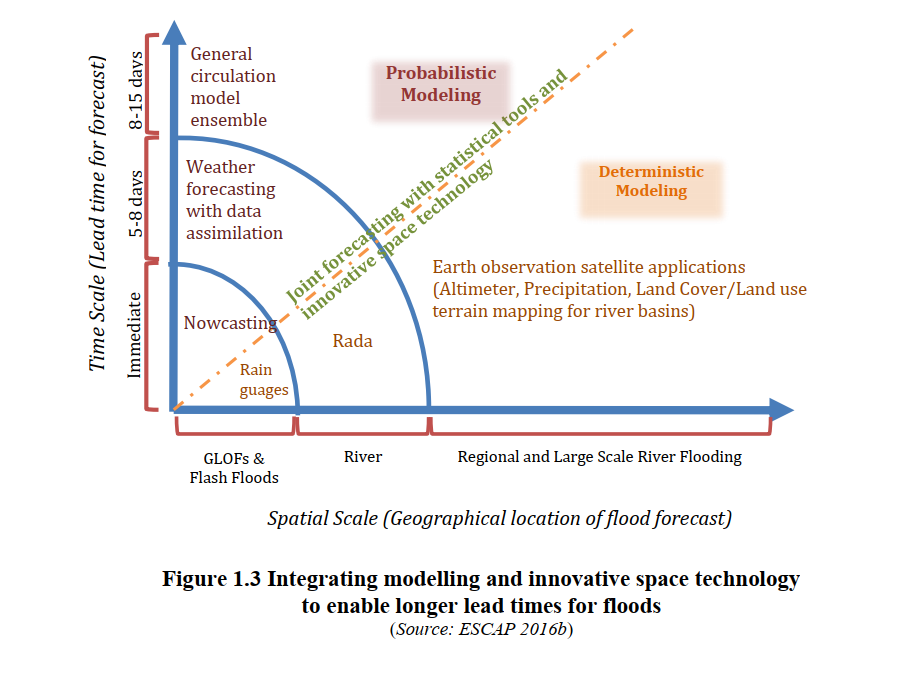
Integrating earth observation data for flood-forecasting: RIMES develops and integrates probabilistic forecast with earth observation satellite data for monitoring precipitation and water elevation contours at different strategic locations and performs:
- Downscaling and application of short- and medium-range forecasts for coastal hazards and river basins
- Development and pilot application of long-lead forecasts
This toolkit has been developed jointly by ESCAP in collaboration with RIMES to provide wider access to these innovations that include a nested modeling framework for the probabilistic forecast as well as conjunctive use of earth observation satellite data for monitoring precipitation and water elevation contours at different strategic locations.